Every fisher
home safe.

BangkaNav turns a fisher's phone into a lifeline — real-time GPS tracking, offline-first trip recording, and one-tap SOS, all on a live monitoring dashboard for coastal LGUs and rescue teams.

Built for Philippine LGUs & coastal communities · Pilot: Bantayan Island, Cebu
Trip synced
SOS · responders alerted
Real-time
Live position streaming
Offline
Records with no signal
1–tap
Emergency SOS
LGU–scoped
Per-municipality access
What it does

Safety tools that work, even out of signal

From the first wave to the harbor, BangkaNav records the trip and keeps a last-known position ready for emergencies.

Real-time tracking

While there's signal, the fisher's phone streams its position to the LGU dashboard — online, delayed, or offline at a glance.
Offline-first recording

Beyond cell range, the trip keeps recording on-device and syncs automatically the moment signal returns — no points lost.

One-tap SOS

A held-confirm distress button sends current and last-known location, battery, and trip to responders — and keeps streaming.

LGU monitoring dashboard

A live map and fisher list scoped to each LGU's waters — national down to barangay — so the right people see the right boats.

Trip history & net trails

Replay any voyage as a route, with fishing spots and net trails kept as separate layers for records and planning.

Privacy by design

Location is sampled only between Start and End Trip, with versioned consent and a tamper-evident audit log — aligned with RA 10173.

How it works

From shore to safe return, in four steps

1

Register the device

The fisher's phone is bound to their profile with a secure, revocable token.

2

Start a trip

One tap begins tracking. A persistent notification keeps recording running.

3

Records anywhere

Online it streams live; offline it stores points and syncs on reconnect.

4

LGU watches over

Admins monitor live, get the last-known position, and act on any SOS.

In the fisher's hand

Simple enough for one hand at sea

The fisher's app is built for sunlight, salt spray, and a moving boat — big targets, clear status, and an SOS that's never more than a tap away.

  • One-tap SOS

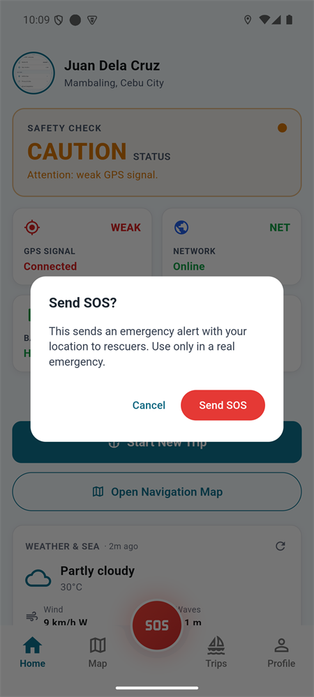
    A hold-to-confirm distress button that sends your location to responders instantly.

  • Works offline

    Keeps recording with no signal and syncs the moment you're back in range.

  • Start / End trip

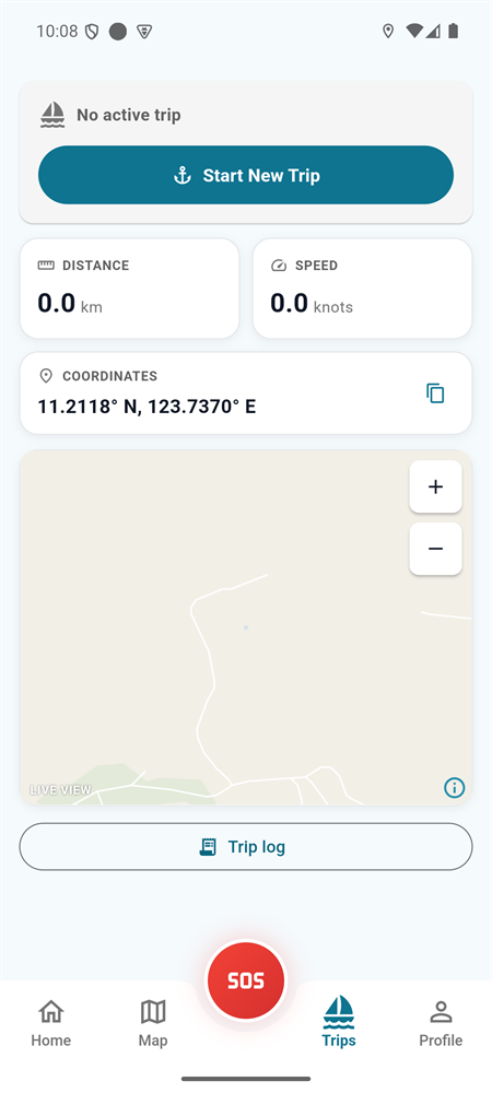
    One tap to begin tracking, with a clear timer and live position the whole way.

  • Always know your status

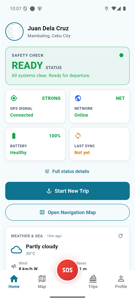
    Connection and unsynced-points indicators you can read at a glance.
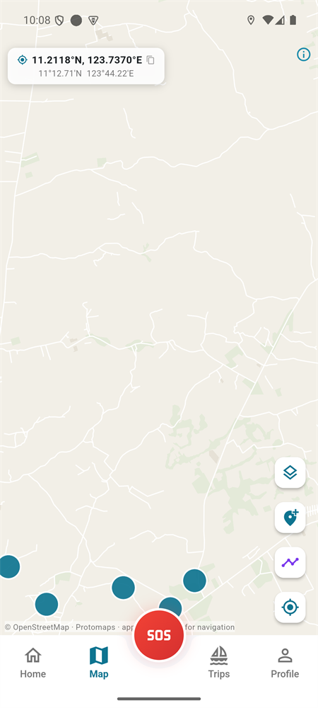
Map & navigation
Trip recording
Home & safety status
Emergency SOS
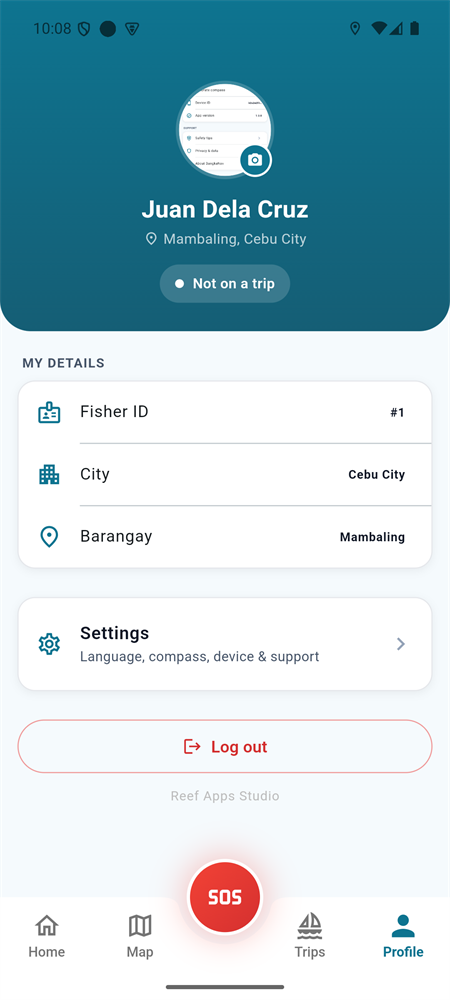
Profile & settings
Why it matters

When minutes matter, a last-known location saves lives.

Most fishing emergencies happen far from cell coverage. BangkaNav is built around that reality — preserving the last position the moment contact is lost, so rescue teams aren't searching blind.

  • Last-known location held server-side for emergency response
  • Offline trips reconcile automatically — nothing dropped on reconnect
  • SOS keeps streaming on a vital-interests basis until resolved
  • Strict LGU-scoped access keeps fisher data with the right authority
Who it's for

One platform, every role on the coast

Fishers

Go out with backup

Simple Start/End trip, a clear unsynced-and-connection status, and an SOS button that works even with patchy signal.

LGU Admins

See your waters live

Monitor active fishers, review trip history, and manage devices and registrations — scoped to your jurisdiction.

Rescue Officers

Respond with a position

A focused SOS queue with current and last-known location plus emergency contacts — acknowledge, dispatch, resolve.

Questions

Frequently asked

Does it work without internet?
Yes. The app records the trip on the phone even with no signal and syncs automatically when coverage returns — so the route and last-known position are never lost.
Is the fisher's location private?
Location is sampled only between Start Trip and End Trip, with versioned consent and a tamper-evident audit log — aligned with the Data Privacy Act (RA 10173). Access is strictly scoped to the fisher's own LGU.
What about emergencies far from cell coverage?
SOS and live tracking need a data connection to reach responders in real time; out of range, the app preserves the last-known position and syncs on reconnect. An SMS/satellite fallback is on the roadmap, and the coverage limit is stated openly to partner LGUs.
Who can see the data?
Only authorized LGU staff and rescue officers, each restricted to their own jurisdiction — a municipal admin sees only their municipality, never another town's fishers.
How is it paid for?
The municipality subscribes on behalf of its fishers — one coverage period per LGU, no per-fisher fee and nothing for a fisher to pay or renew. Each payment is recorded against the municipality and the dashboard shows the covered dates, with a reminder five days before a period ends.
What happens if the subscription lapses?
Safety is never switched off. SOS keeps working, fishers keep their accounts, and the app keeps recording every trip on the phone. Only uploading to the dashboard pauses — nothing is lost, and everything queued syncs automatically once the LGU renews.
How do we bring it to our LGU?
BangkaNav is pilot-ready. Get in touch and we'll set up a demo and walk through onboarding your fishers and rescue team.
Get started

Bring BangkaNav to your coastal community

Pilot-ready for Philippine LGUs. Talk to us about a demo, sign in to the dashboard, or explore what the platform can do.